
Page 58 - KBHA BULLETIN 4
P. 58
55
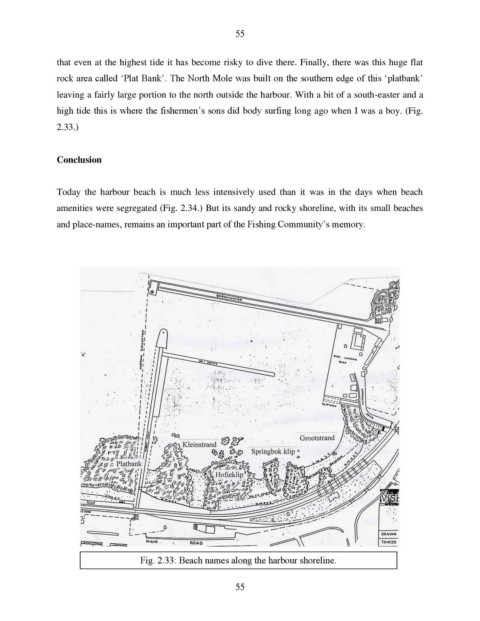
that even at the highest tide it has become risky to dive there. Finally, there was this huge flat
rock area called ‘Plat Bank’. The North Mole was built on the southern edge of this ‘platbank’
leaving a fairly large portion to the north outside the harbour. With a bit of a south-easter and a
high tide this is where the fishermen’s sons did body surfing long ago when I was a boy. (Fig.
2.33.)
Conclusion
Today the harbour beach is much less intensively used than it was in the days when beach
amenities were segregated (Fig. 2.34.) But its sandy and rocky shoreline, with its small beaches
and place-names, remains an important part of the Fishing Community’s memory.
Fig. 2.33: Beach names along the harbour shoreline.
55